Clutton Site Options
Clutton is well located on the A37 corridor. The village could initially accommodate 40-50 homes but future phases could be brought forwards through the development of strategic masterplans.
Clutton is a historic village with a rich heritage dating back to the Iron Age. It evolved from a farming community into a centre for coal mining and associated industries, including brickworks, glass manufacture, and haulage. Today, Clutton retains its rural character and distinct identity, supported by an adopted Neighbourhood Plan that sets out a clear vision for the parish to 2035. The plan seeks to maintain the tranquil and rural nature of the area, protect its landscape and biodiversity, and support well-designed housing, low-impact employment opportunities, and improved community facilities. The village has a moderate level of connectivity and a limited but valued range of services and facilities, including a primary school.
A current planning application in Clutton proposes the creation of a school recreation ground with new maintenance access off Broomhill Lane (Use Class F1), alongside residential development for up to 30 dwellings (Use Class C3), including associated access improvements, landscaping, drainage, and public open space. The site lies within the Green Belt, and its consideration will be subject to the Development Management process. However, it is noted that the revised National Planning Policy Framework introduces the concept of ‘Grey Belt’, which may be relevant in assessing the proposal’s alignment with strategic planning objectives.
While the local plan does not seek to pre-judge individual applications, it is important to highlight the value of a coordinated and strategic approach to growth in Clutton. This approach aims to ensure that development contributes positively to local priorities, including affordable housing, community infrastructure, and environmental quality.
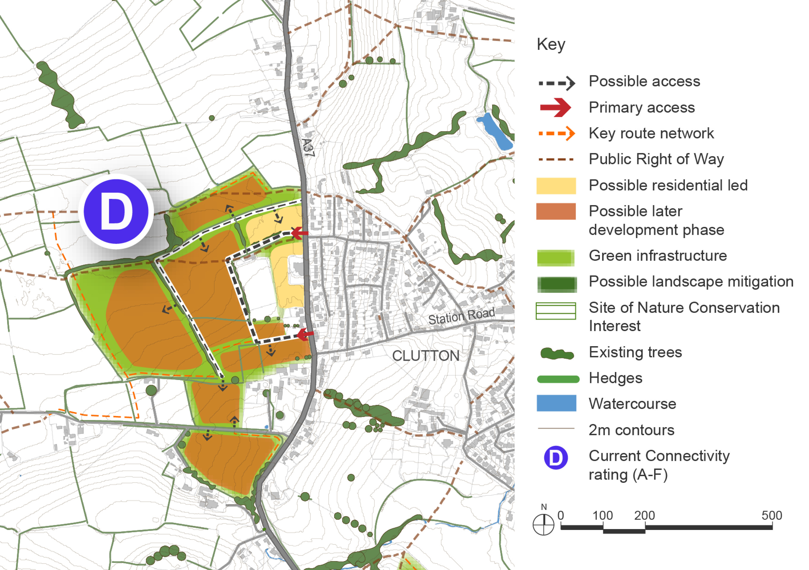
In Clutton, land to the west of the A37 has been promoted for development. The location aligns with the Neighbourhood Plan’s direction of growth and could form a well-integrated extension to the village, with improved crossings of the A37 required. Development at this location could support delivery of the permitted farm shop.
The site could accommodate an initial phase of around 40-50 homes, providing modest growth slightly above the 5% baseline. A more strategic approach could deliver a comprehensively masterplanned extension, phased to align with infrastructure delivery. Later phases would only be released when key requirements are met, including A37 crossing improvements, school and healthcare capacity, and environmental mitigation. A site-specific masterplan and design code would guide delivery, ensuring high-quality design and integration with the existing settlement. Further phases identified west of the A37 (between 320–430 homes) and south of Stowey Road (between 60–80 homes) could be explored, subject to robust assessment, infrastructure capacity and environmental constraints.
Connectivity scores shown on the site options plan below are based on the Department for Transport’s A–J grading, where A is the highest within B&NES.
Clutton Site Options – Indicative plan
Click to enlarge
Clutton Site Options – Key information
| Element | Description |
| Development opportunities |
|
| Constraints |
|
| Mitigation |
|
| DfT current connectivity rating |
|
| Further evidence required |
|