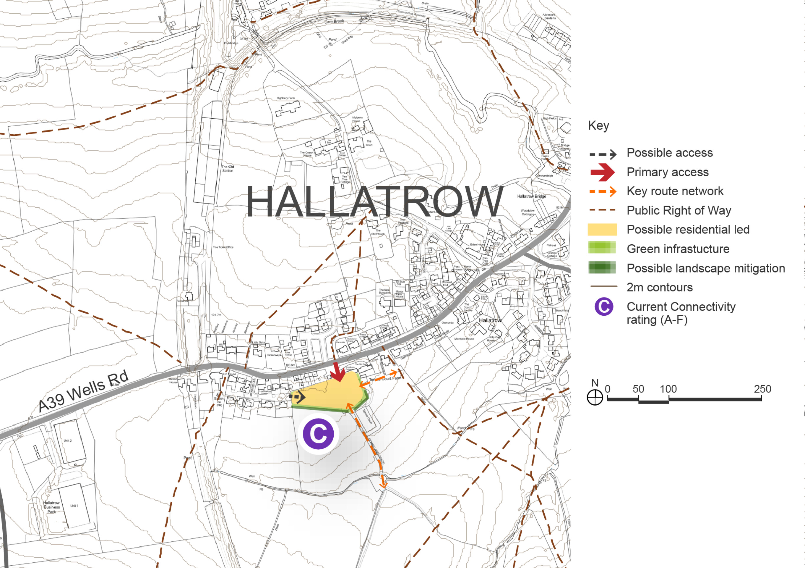
Combe Lane, Site Option
The Combe Lane site is located in the village of Hallatrow. A relatively small site, it has the potential to deliver 15-20 new homes.
High Littleton and Hallatrow form a connected parish located to the south-west of Bath. The area has a strong rural character and a rich heritage, with a mix of historic buildings and green spaces. The villages benefit from a modest range of services and facilities, including a primary school, local shops, and community amenities. Connectivity is moderate, with access to the A39 corridor, though transport pressures and infrastructure capacity remain key considerations.
The parish is covered by the High Littleton and Hallatrow Neighbourhood Plan, which was successfully examined and brought into force in 2025. The Plan sets out a locally driven vision for the area, with a focus on protecting landscape character, enhancing biodiversity, and supporting small-scale development that reflects the needs and aspirations of the community.
Land has been promoted for development within the parish, and site assessments have been submitted by the parish council for consideration. These include locations with potential for sustainable growth, subject to further assessment of landscape sensitivity, infrastructure capacity, and ecological constraints. The council considers it appropriate to test options for modest growth in the area, in line with the Neighbourhood Plan’s emphasis on locally responsive development.
Due to the high landscape sensitivity around High Littleton, only limited options have been identified. However, there is potential for smaller-scale growth in Hallatrow, which may offer a more appropriate location for proportionate development, subject to further assessment.
A site at Combe Lane in Hallatrow is presented for this consultation for between 15-20 homes. This site is located opposite the recently completed Fox Fields development within the village. Land to the north of Fox Fields was also considered; however, it was discounted due to the potential loss of Grade 1 agricultural land, which is recognised as a significant constraint.
Development at Combe Lane would need to be sensitively designed to respect the village’s character and landscape setting, with a focus on delivering affordable housing and supporting local needs. Further evidence will be required to assess landscape and visual impact, transport and access feasibility, and infrastructure capacity to ensure that any growth is sustainable.
Connectivity scores shown in the site option below are based on the Department for Transport’s A–J grading, where A is the highest within B&NES.
Combe Lane Site Option – Indicative plan
Click to enlarge
Combe Lane Site Option – Key information
| Element | Description |
| Development opportunities |
|
| Constraints |
|
| Mitigation |
|
| DfT current connectivity rating |
|
| Further evidence required |
|