Land to the North of Midsomer Norton Site Option
Land to the north of Midsomer Norton and west of Paulton consists of agricultural fields. The area is just over 1km walk to Midsomer Norton Town Centre. There are a number of public rights of way across the fields and some residential dwellings.
Landscape character is an important attribute of the area. The green hillsides are integral to the setting of Midsomer Norton. Any new development should be confined to the plateau above the town and should not encroach onto the green hillsides or the landscape setting of Midsomer Norton.
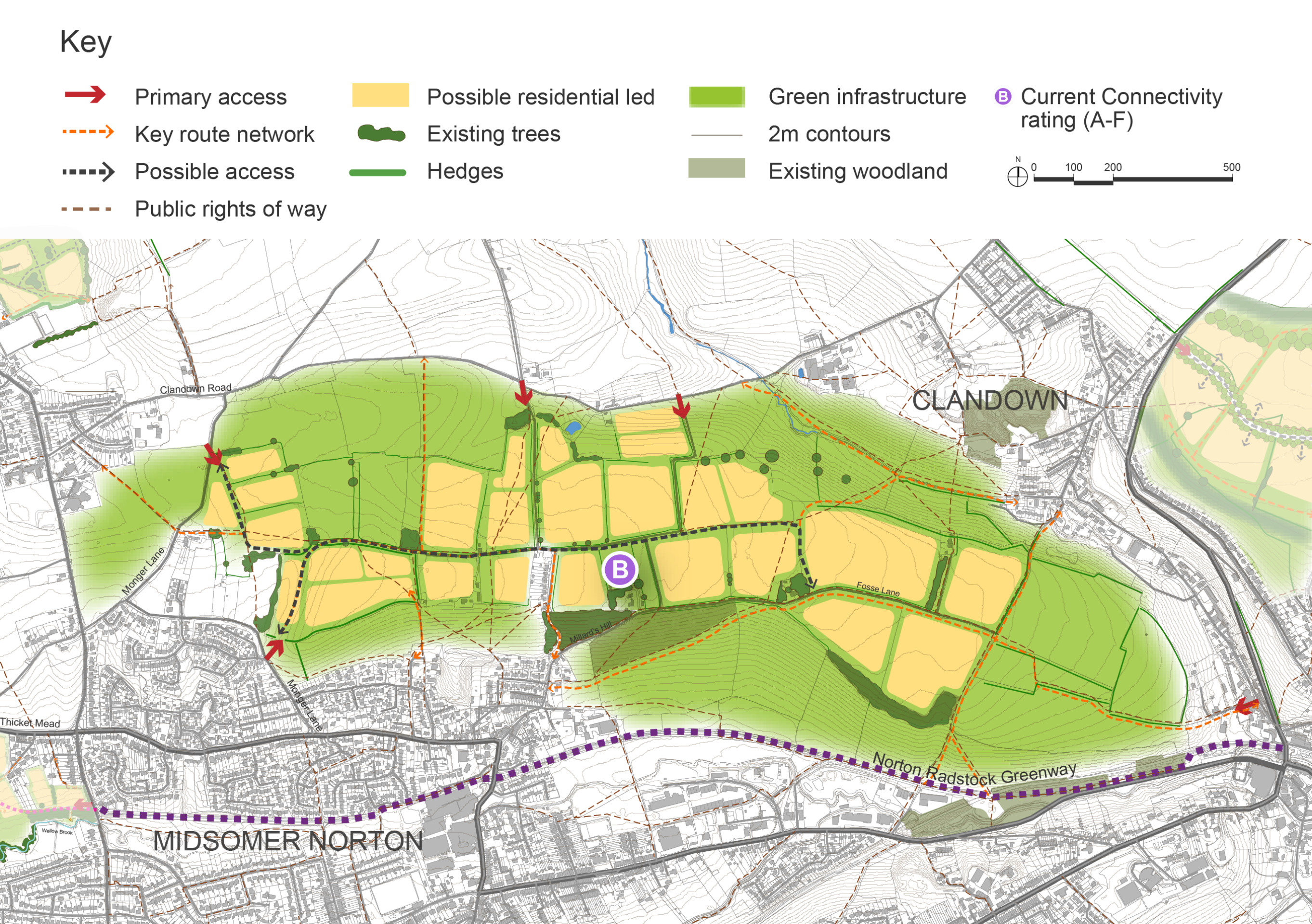
The site is currently accessed by a series of narrow lanes and any development would need to improve access to the site, incorporating wider roadways and footways. The western part of the site is within walking distance of the 172 bus route providing access to Paulton, Bristol and Bath. Should a wider area be brought forward for development then there is an opportunity to provide a new link between Paulton and Clandown. Development should provide pedestrian links to public transport, town centre facilities and schools.
The site sits to the north of the designated Conservation Area which extends up the green hillsides. To the west of the site planning permission has recently been granted for a solar farm. Nearby Bowditch Quarry is a SSSI.
The site option presented below could provide up to around 1,000 homes, as well as supporting facilities and green infrastructure. The development would need to be landscape led with screening needed to the north and south alongside landscape buffers to ecological assets.
The site is currently accessed by a series of narrow lanes. Therefore, any development would need to significantly improve the current access to the site, incorporating wider roads and pavements. Part of the site to the west is within walking distance of Phillis Hill providing access to bus services to the local area as well as Bristol and Bath.
There is a potential opportunity to provide a new route linking Paulton and Clandown. It is envisaged that the route would play a strategic role, removing vehicles from Midsomer Norton and Radstock town centres and helping to relieve congested local roads. This will enable significant improvements to be made to the wider area enabling enhancement of the public realm and increasing space and facilities for sustainable modes of transport. Development will also provide active travel links to public transport, town centre facilities and schools to improve connectivity and make sustainable travel a viable realistic option for more people.
If this option is pursued through the Local Plan, further detailed studies will need to be conducted to understand the broader impacts including the effect on the wider transport network.
Land to the North of Midsomer Norton – Indicative plan
Click to enlarge
Land to the North of Midsomer Norton – Key information
| Element | Description |
| Development opportunities |
|
| Constraints |
|
| Mitigation |
|
| DfT current connectivity rating |
|
| Further evidence required |
|