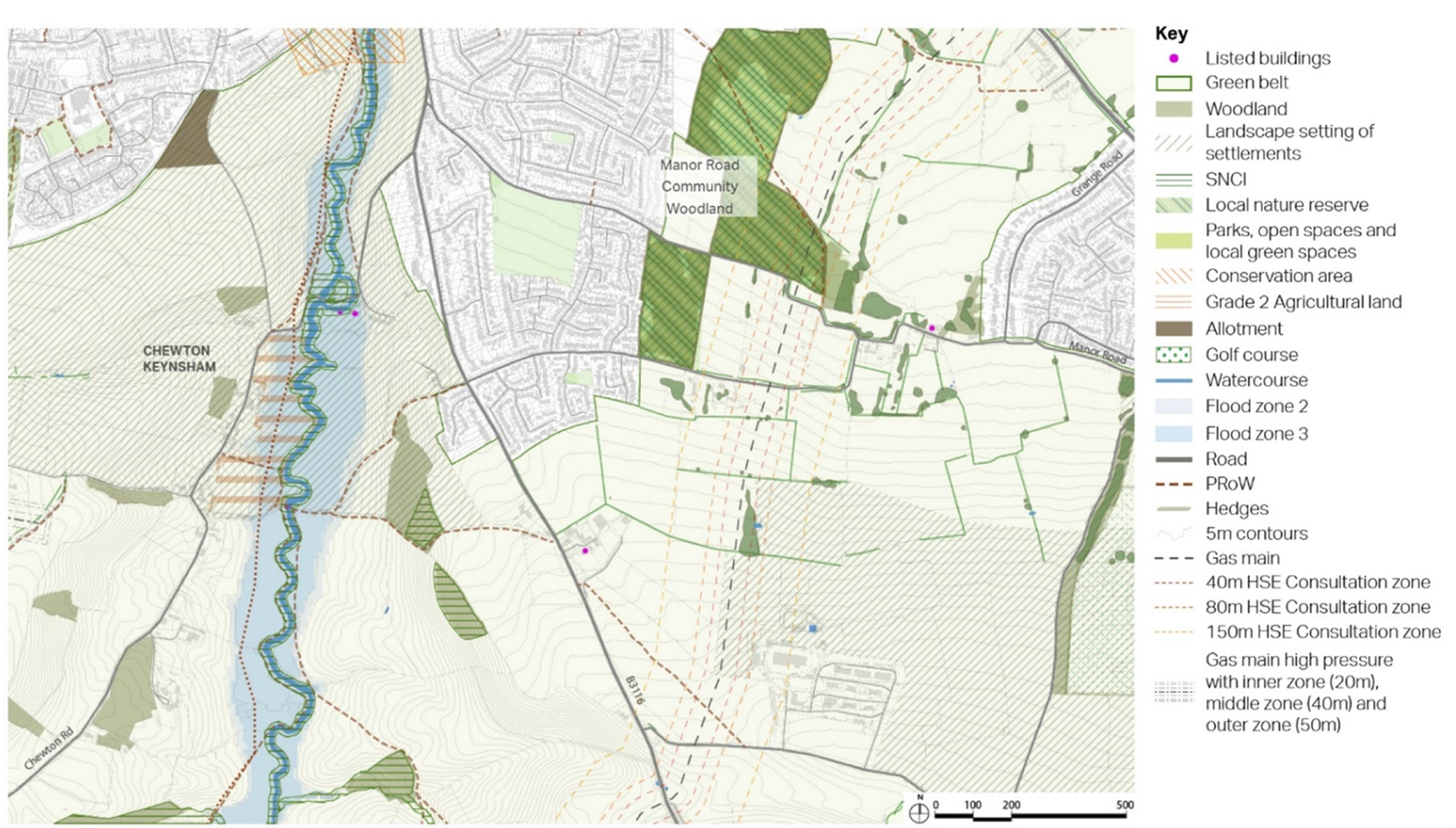
South East Keynsham Site Option
The South East Keynsham site consists two parcels of land which sit either side of the Wellsway (B3116). It is being considered as one single site which has the capacity to deliver 350-500 homes.
Currently located in the Green Belt, further assessment is required before the sites can be released. There are also many other constraints that would need to be resolved through a range of mitigations to make the development of the sites acceptable in planning terms.
South East Keynsham is located to the south of the east side of Keynsham, comprising two parcels of land located to the east and west of Wellsway (the B3116). Wellsway connects the town to the A39 to the south.
The parcel located to the west of Wellsway is used as arable land and is bounded by residential homes to the south and north, and woodland to the west.
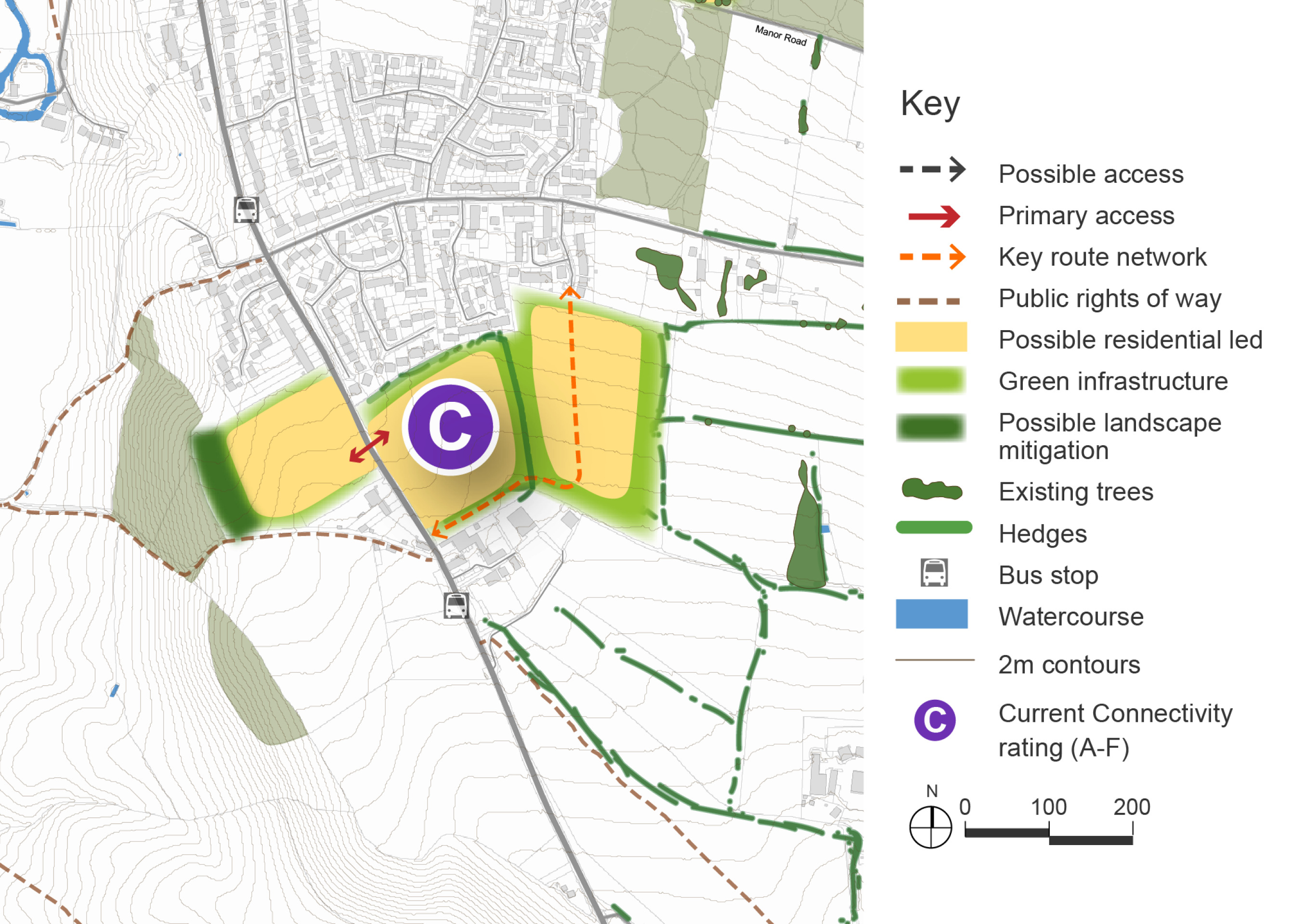
The parcel located to the east of Wellsway is also used as arable land. Options to provide a walking and cycling route up into Keynsham would need to be explored due to a lack of permeability between the land parcel and the residential development adjoining it to the north.
A bus stop providing a twice hourly bus service into Bristol to the north, and the Somer Valley to the south, is located on Wellsway close to the site. However, improvements to walking infrastructure to reach the bus stops from the site would be required as limited pavement currently exists.
The nearest existing convenience shop is located on Chandag Road, approximately 1 mile away from the site.
The site is located in the Green Belt. Any release from the Green Belt and subsequent allocation for development will need to demonstrate exceptional circumstances. To understand and consider the impact of potential development on the Green Belt an assessment of the extent to which different parcels of land serve the five purposes is being undertaken. The emerging Stage 1 Strategic Green Belt Assessment being carried out by WECA will assess the site for its contribution towards meeting the five Green Belt purposes and also whether it meets the definition of grey belt set out in the NPPF and updated Planning Practice Guidance, which is sequentially preferable to greenfield Green Belt in national policy. The assessment work is ongoing and will inform the Draft Local Plan. It is likely that following the Stage 1 Strategic Green Belt Assessment a more detailed (stage 2) assessment of the impact of development on more specific areas of the Green Belt will also be required.
South East Keynsham context plan
Click to enlarge
South East Keynsham Site Option - Indicative plan
Click to enlarge
South East Keynsham - Key information
| Element | Description |
| Development opportunities |
|
| Constraints |
|
| Mitigation |
|
| DfT current connectivity rating |
|
| Further evidence required |
|