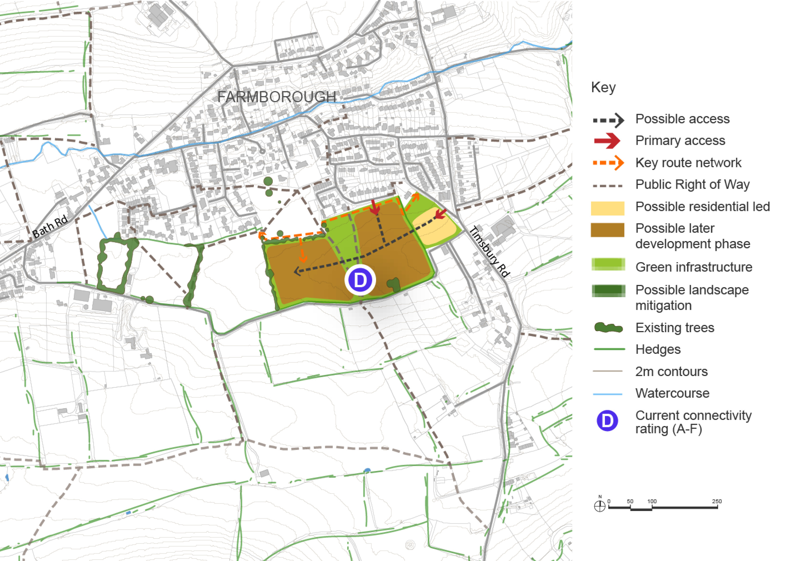
Timsbury Road Site Option
The Timsbury Road site in Farmborough is located to the south of the village and has the potential to provide 25 – 35 homes. The land is currently in the Green Belt but could be released following further assessment if the case can be robustly justified. There is also potential for future phases providing an additional 70 – 90 homes.
Farmborough is a moderately sized village located to the west of Bath, inset from the Green Belt. It has a moderate range of services and facilities, including a primary school, village hall, and a community-run local shop, which plays an important role in supporting day-to-day needs. While the village benefits from reasonable connectivity, there are known constraints including access to sustainable transport options.
The village has demonstrated strong community engagement, including the successful delivery of UK Shared Prosperity Fund-funded projects such as energy efficiency improvements to the Village Sport & Social building. Together with the operation of the community-run shop, this reflects a proactive local approach to sustainability and community-led service provision. Farmborough’s location, service base, and community capacity make it potentially suitable for proportionate growth, with potential to support wider infrastructure and placemaking objectives.
A site to the south of Farmborough, accessed from Timsbury Road, has been promoted for development. Although the land lies within the Green Belt, it is well-related to the existing built form and is being considered as a potential location for proportionate growth. The site could accommodate a modest level of housing initially, between 25-35 homes, with the potential for further phases depending on infrastructure capacity and the ability to deliver wider community benefits.
Any development would need to demonstrate exceptional circumstances for Green Belt release, supported by a robust evidence base including landscape, infrastructure, and sustainability assessments. A key requirement would be the delivery of new green space, with one option under consideration being its integration with the existing Village Hall and community-run shop. This would enhance local connectivity and reinforce the role of these facilities as focal points for village life.
Two recent permission in principle applications have been submitted for up to nine dwellings each—one on land off Little Lane, where potential for growth is being considered through the local plan, and another on the opposite side of the village between Bath Road and Brookside Drive. While these proposals reflect ongoing development interest, the local plan and parish council support a more strategic and coordinated approach to growth in Farmborough. This aims to ensure that new development delivers meaningful benefits for the community, including affordable housing, infrastructure improvements, and enhanced public spaces, rather than piecemeal schemes that may offer limited wider value.
Connectivity scores shown in the site option plan below are based on the Department for Transport’s A–J grading, where A is the highest within B&NES.
Timsbury Road Site Option – Indicative plan
Click to enlarge
Timsbury Road Site Option – Key information
| Element | Description |
| Development opportunities |
|
| Constraints |
|
| Mitigation |
|
| DfT current connectivity rating |
|
| Further evidence required |
|