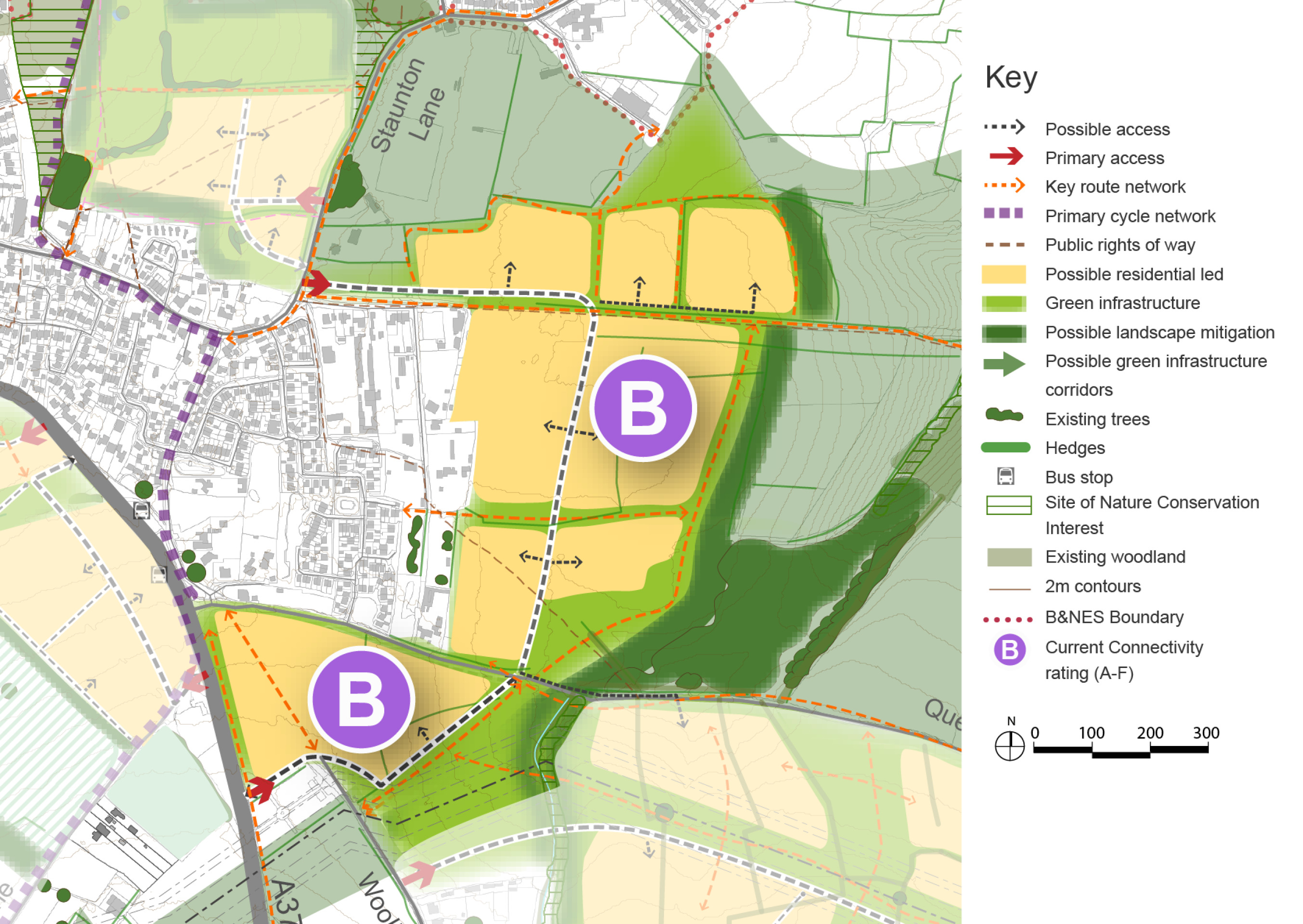
East Whitchurch Site Option
The East Whitchurch site comprises two main parcels land; the land adjoining the village to the east, currently occupied Horseworld and the land located directly east of the A37 between the A37 and Queen Charlton Road
The site option is located in the Green Belt. Any release from the Green Belt and subsequent allocation for development will need to demonstrate exceptional circumstances. To understand and consider the impact of potential development on the Green Belt an assessment of the extent to which different parcels of land serve the five purposes set out in national policy is being undertaken. The emerging Stage 1 Strategic Green Belt Assessment being carried out by WECA will assess the site for its contribution towards meeting the five Green Belt purposes and also whether it meets the definition of grey belt set out in the NPPF and updated Planning Practice Guidance, which is now sequentially preferable to greenfield Green Belt in national policy. The assessment work is ongoing and will inform the Draft Local Plan. It is likely that following the Stage 1 Strategic Green Belt Assessment a more detailed (stage 2) assessment of the impact of development on more specific areas of the Green Belt will also be required.
East Whitchurch Site Option – Indicative plan
Click to enlarge
East Whitchurch Site Option – Key information
| Element | Description |
| Development opportunities |
|
| Constraints |
|
| Mitigation |
|
| DfT current connectivity rating |
|
| Further evidence required |
|