Excelsior Terrace Junction
Project Area: Excelsior Terrace
Existing context
The area covered by this concept refers to the sequence of spaces between the High Street and South Road / Excelsior Terrace, including the junctions with Rackvernal Road and Gullock Tyning.
This area is unusual in that South Road and Gullock Tyning are post-war roads which were delivered in the 1960s to try to address some of the challenges presented by a narrow historic High Street. As such, they don’t necessarily reflect the historic street character of the wider town, and prioritise vehicle movements over pedestrians as was the prevailing trend at the time.
The existing arrangement serves to divide the two halves of the High Street and to weaken links to the leisure centre and Town Park. This can be addressed through the application of modern design standards and placemaking principles.

Site location plan – click to enlarge
Existing condition
The existing junction with the High Street dates from the post-war period when the design standards were structured to prioritise the ease of vehicle movements. This led to gentle curves and wide open junctions which favour vehicles, but hinder pedestrians.
The modern transport hierarchy requires designers to consider the pedestrian facilities first - improving accessibility and supporting walking and cycling for short trips. Big vehicles will still have the room they need to manoeuvre safely, but they will need to slow down.
The area also presents further challenges in terms of the pavement widths past the car parking space in front of the shops and then continuing past the almshouses, where the pavement is not wide enough to pass - particularly for someone with a buggy, in a wheelchair or mobility scooter, or walking with assistance.
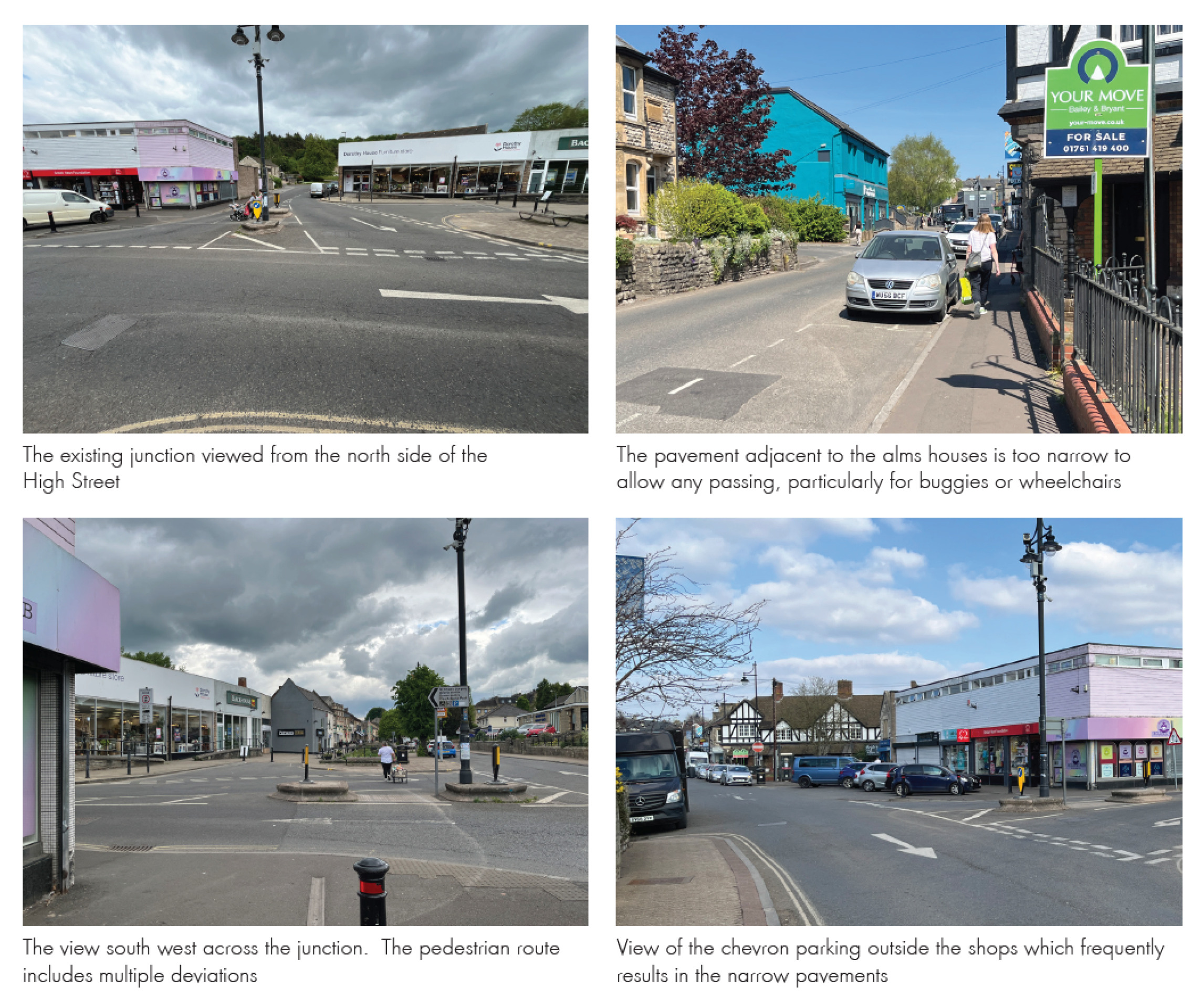
Photographs – click to enlarge
Opportunities
Establish a better main crossing for pedestrians which provides a shorter and safer connection between the two parts of the High Street.
Provide parking for disabled users on the High Street in the most accessible location, removing the potential barrier to buses from the existing arrangement.
Reduce the overall carriageway space with tighter junction corners whilst allowing for safe vehicle movements including buses.
Provide wider pavements and safer crossing points which deliver the aims of the Active Travel Masterplan including improved connections to the Leisure Centre, the Town Park and the Five Arches route.
Explore options to daylight (de-culvert) the river for an additional stretch along the High Street.
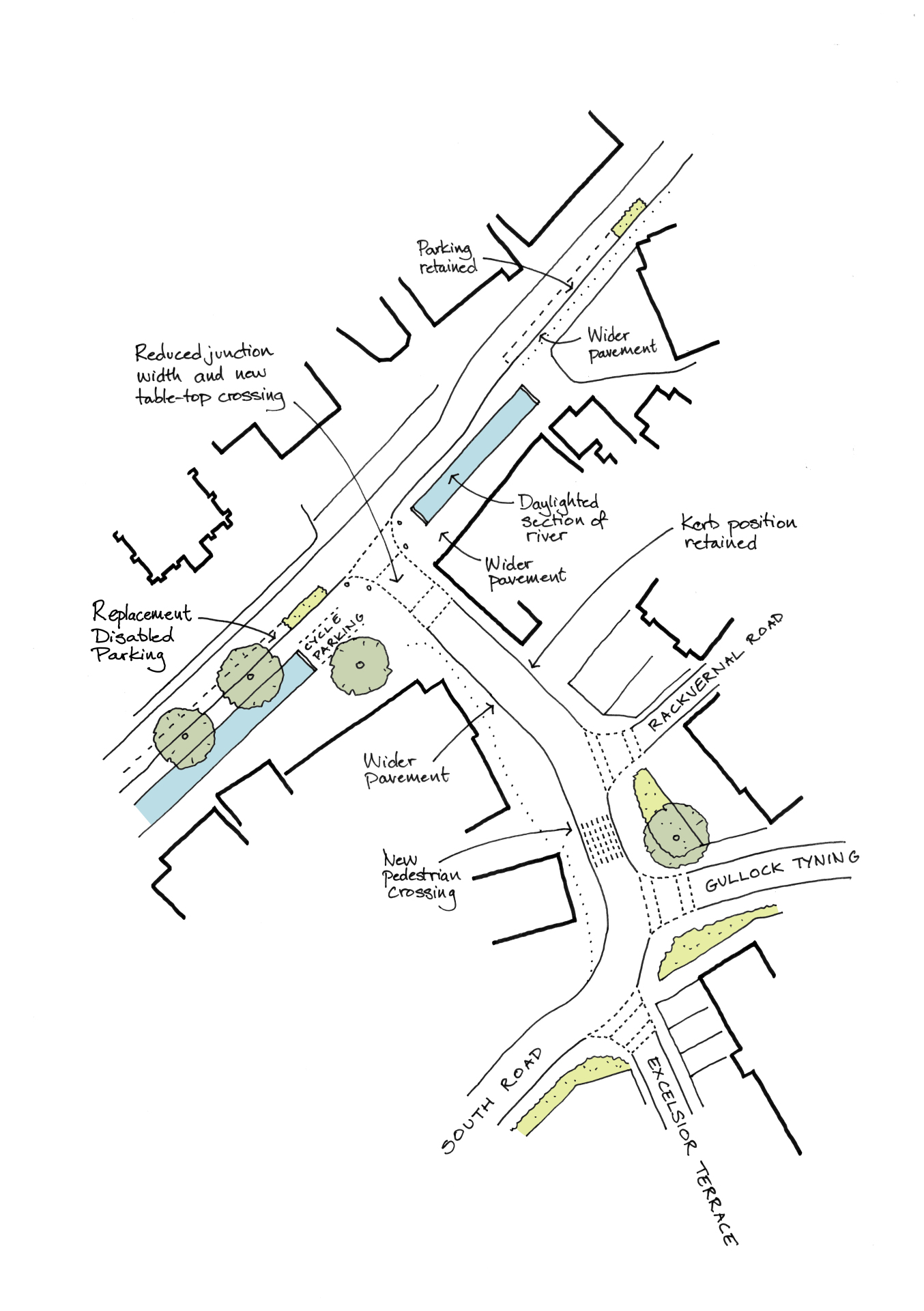
Concept drawing – click to enlarge
Technical testing
It is important to note that whilst the junction will be considerably reduced in scale, the approach is consistent with modern design standards and current best practice.
In support of the concept design development a detailed test has been undertaken to validate the approach and to confirm that the largest vehicles including buses and articulated lorries will be able to manoeuvre safely.
Further details of this work can be found in the supporting transport and movement appendix.

Tech – click to enlarge